1. Intelligent Identification and Monitoring System for Ecological Environment Hazards in Qinling Mountains
March 2023 - Present
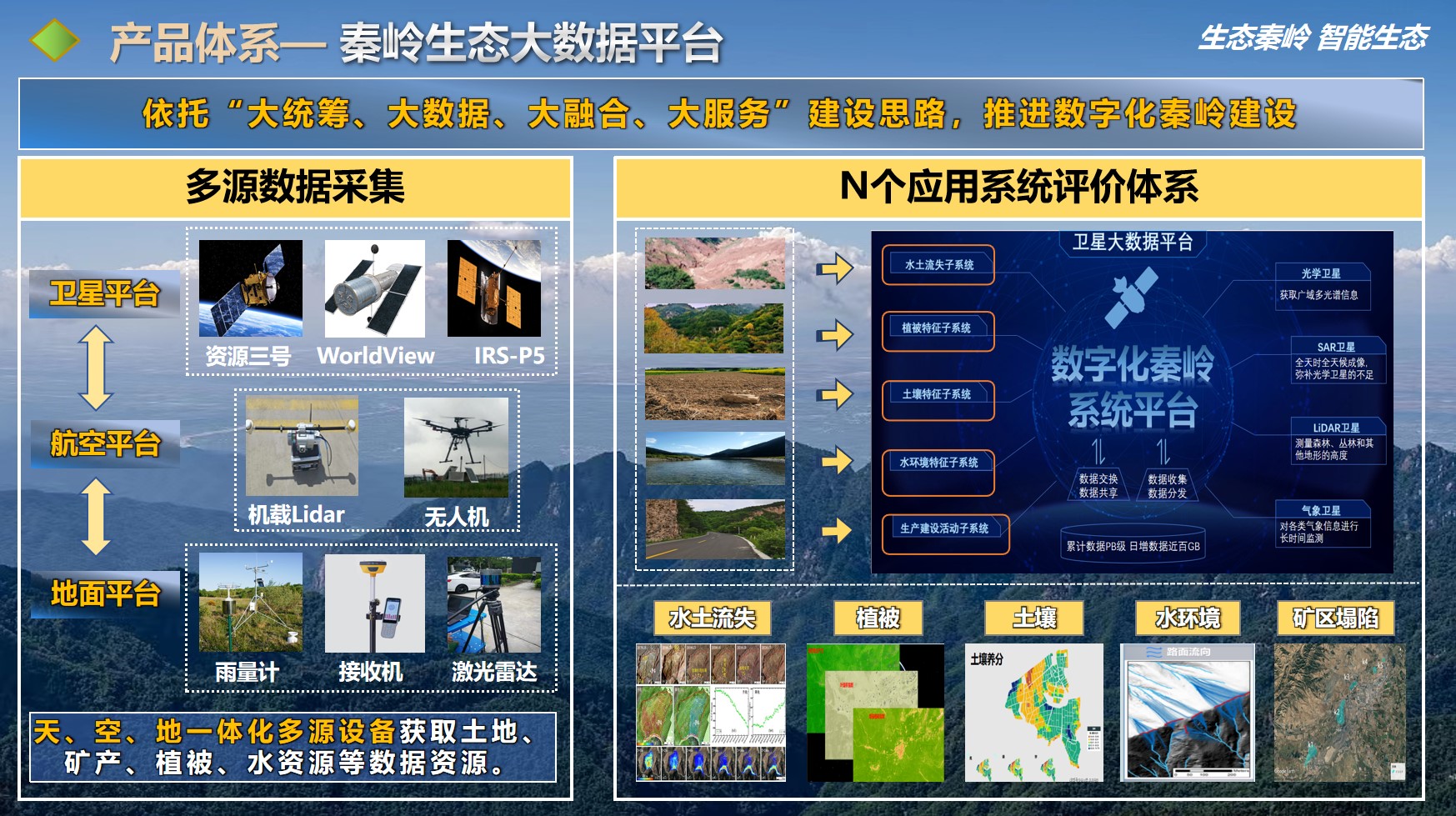
Utilized remote sensing and InSAR technologies to monitor vegetation, mines, geological disasters, etc., in the Qinling region.
Established a "1+3+N" Qinling Ecological Big Data Smart Platform for the identification and intelligent monitoring of ecological environment hazards.
Contributed to the construction of a beautiful Qinling by providing technological support for hazard identification and monitoring.
2. Intelligent Emergency Response System for Co-seismic Landslides based on PIE Cloud Platform
December 2022 - Present
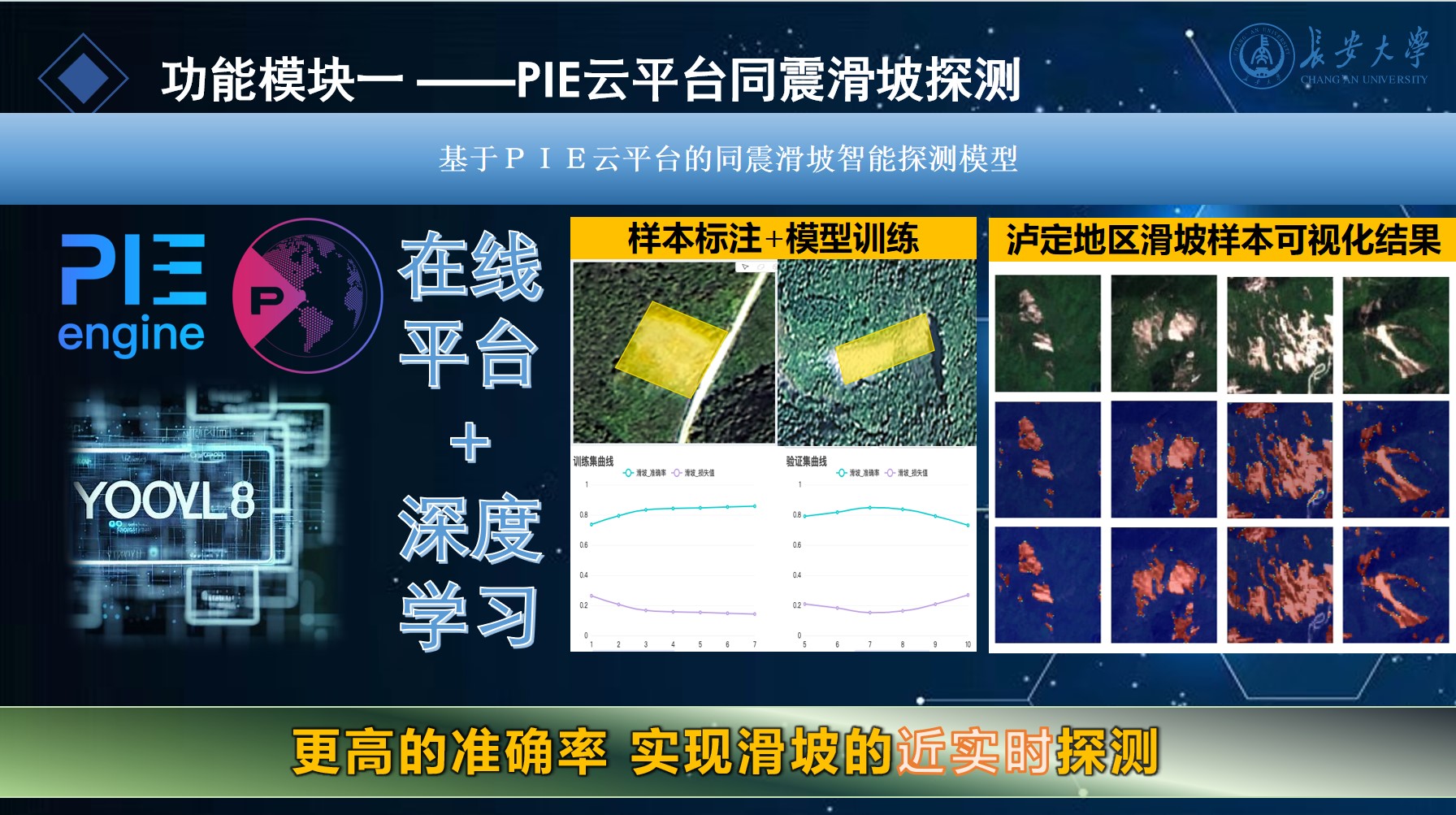
Deployed Yolo8 deep learning algorithm on the first remote sensing cloud platform PIE-engine in China for landslide identification.
Trained SVM model on PIE cloud platform for landslide susceptibility assessment.
Developed an integrated product for intelligent landslide detection, susceptibility assessment, and rescue path planning, providing a new solution for post-landslide rescue.
Achieved a recognition accuracy of 90% for landslides in the Luding area using the Yolov8 algorithm.
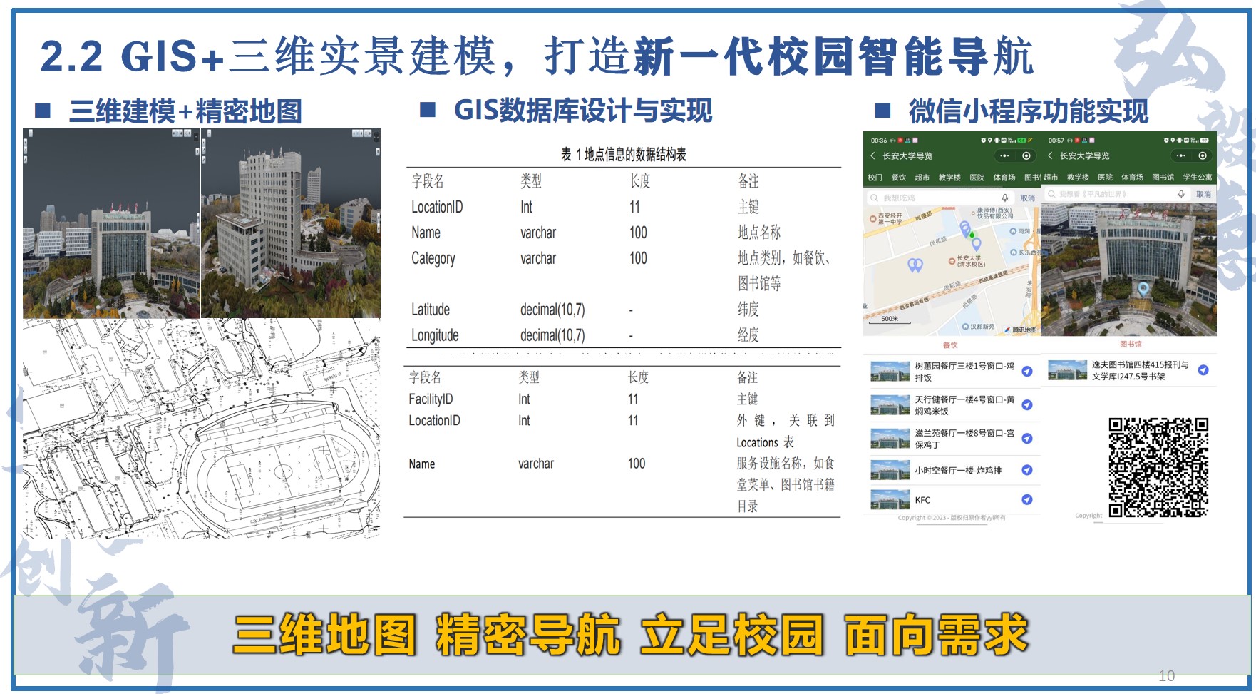
3. Design and Implementation of Campus Intelligent Navigation Based on GIS and 3D Scene Modeling
October 2021 - January 2024
Developed a precise campus map using GPS and total station measurements.
Utilized drone aerial photography to create a 3D model of the campus terrain.
Built location information and service facility databases, and developed the Chang'an University Campus Intelligent 3D Navigation Mini Program on the WeChat platform using Vue, ElementUI, MINA, etc.